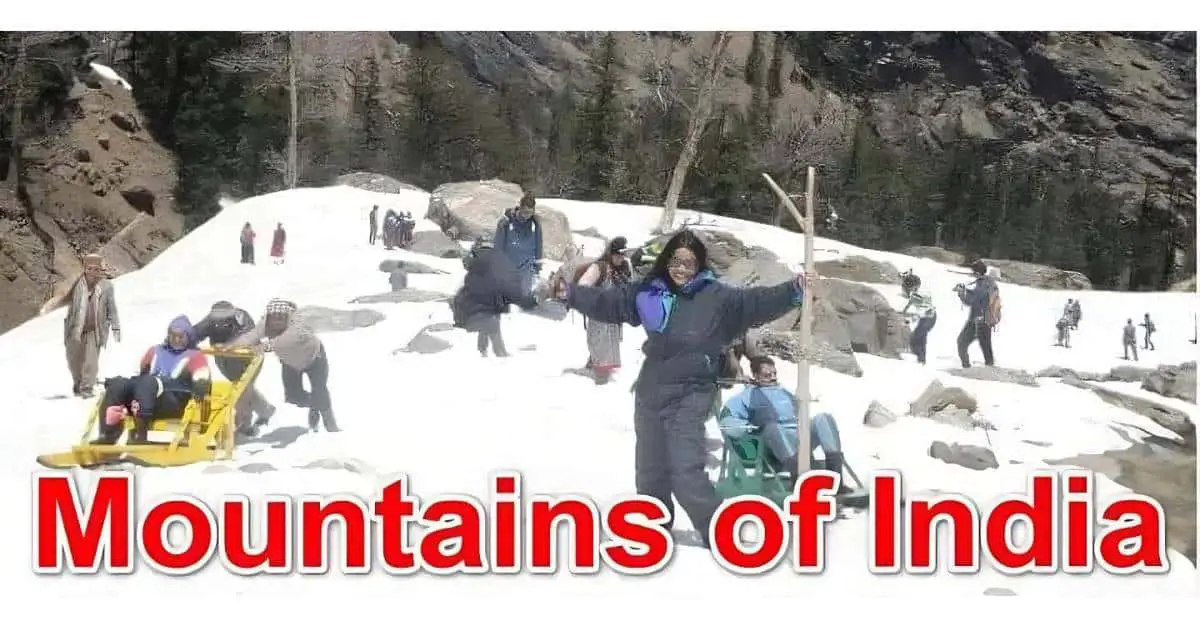
List of 30 Highest Mountain Peaks in India
India has many mountain Peaks. The Aravalli Range is the oldest fold mountain, and the Himalayas are called young fold mountains. Mussoorie, 35 km from Dehradun, is called “the queen of hills.”
Phawngpui, or the blue mountain in Mizoram, is 7077 ft. Barren Island in the Andaman Sea is the only active volcanic mountain in the Indian subcontinent. K2 (Godwin-Austen) is the 2nd-highest mountain in the world.
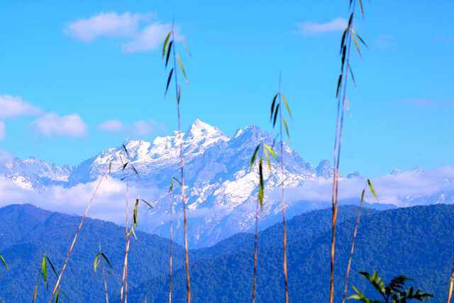
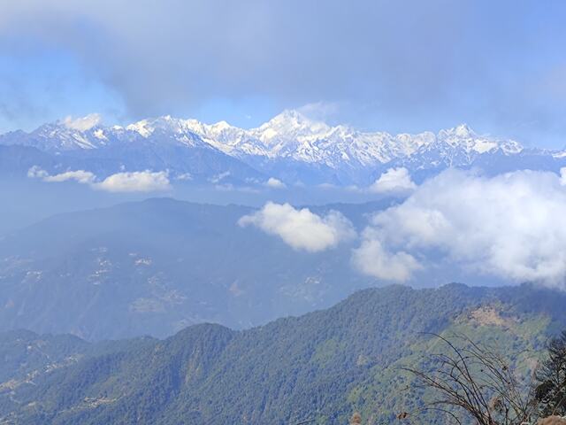
Jindhagada Peak, the highest in the Eastern Ghat, is 4925 ft. Doddabeta, 8650 ft, is the highest peak in South India. Kanchenjunga borders India, and Nepal is the highest point in India.
A landform is a natural feature on Earth. The main landforms are plateaus, plains, and mountains. Mountains are natural elevations on Earth’s surface. They are narrow on top and broad at the base. There are four types of mountains: fold mountains, block mountains, volcanic mountains, and dome mountains.
List of the Top 30 Highest Mountain Peaks in India
1. Kanchenjunga Mountain
Kanchenjunga is the third-highest mountain worldwide. It is composed of rocks from the late Precambrian (Neoproterozoic) to the Ordovician era (445 to 1 billion years old).
In the Eastern Himalayas, Kanchenjunga is part of the Great Himalayan Range. It’s one of the Highest Peaks and the oldest mountain ranges in India.
Kanchenjunga Height
Kanchenjunga, the world’s 3rd highest mountain, has an elevation of 8586 m or 28,169 ft.
Kanchenjunga Expedition
The Kanchenjunga expedition begins in Biratnagar, heading to Suketar, or a trip to Bhadrapur towards Taplejung. It then follows through villages and forests to the Kanchenjunga Base Camp (4500 m).
There are four camps for expeditors who wish to summit Kanchenjunga: the first (6050 m), the second (6800 m), the third (7300 m), and the fourth (7800 m). The Kanchenjunga climb ends with a retrace to Ghunsa. This adventurous expedition requires 45-50 days to complete.
Kanchenjunga Range Peaks
“Kanchenjunga” is rooted in Tibetan origin and translates as “Five Treasuries of the Great Snow” in Sikkim. Mt. Kanchenjunga has five significant peaks, four of which are above 8400 m.
| Peaks | Elevation |
| Main summit | 8586 m |
| West summit | 8505 m |
| Central summit | 8482 m |
| South summit | 8494 m |
| Kangbachen | 7903 m |
Kanchenjunga Temperature
Summer season
Summer in Mt. Kanchenjunga starts in March and continues up to May. The average temperature during this time ranges from 10 degrees to 28 degrees.
Winter season
Winter here starts in December and continues until February. The average temperature ranges from minus five degrees to 16 degrees.
Best time to visit Kanchenjunga
The best time to visit Kanchenjunga is during Spring and Autumn.
In the Spring season (March to late May)
The weather is nearly perfect. The temperature of high altitudes is not as cold as it is in winter. The climate of trekking trails in the lower region is also excellent. Forests start to bloom, and expeditions might have time to view exotic and endangered wildlife while passing through them. At that time, no clouds were in the sky; thus, the green forest and snow-capped mountains looked stunning.
In the Autumn season (late September to mid-December)
Early Autumn is the best time to trek to Kanchenjunga Peak. The weather remains perfect, with fewer clouds and wind, and the climate is mild (neither cold nor hot). During Autumn, many festivals take place, and Expeditors can enjoy local culture and delicacies.
Kanchenjunga Base Camp Trek
The trek to Kanchenjunga’s base camp starts from Yuksom and continues towards Bakhim, Bikhbari Chaurikhang, Rathong Glacier, Dzongri, Bikhbari, and Laxmi Pokhari, ending at Bakhim.
The Kanchenjunga base camp trek covers 90 km and usually takes 11-12 days. Trekkers enjoy the view of Mt Kanchenjunga, Mt Pandim (6,691 m), and Mt Kokthang (6,148 m). The Kanchenjunga Conservation Reserve falls en route to the Kanchenjunga base camp trek. It’s home to animals like Red Pandas and Snow Leopards.
How to reach Kanchenjunga
Nepal or Sikkim generally reaches Kanchenjunga. The safest route for the trek is from Nepal, as Sikkim has harsh road conditions. Trekkers must reach Yuksom and then trek to Lamuney (a trekking spot on Kanchenjunga mountain).
The base camp trek starts from North to South or South to North. Take a 45-minute flight from Kathmandu to Bhadrapur and reach Taplejung. Next, reserve a jeep after the Bhadrapur flight and a bus to Taplejung.
Kanchenjunga Location
Kanchenjunga is located in the Eastern Himalayas, between Eastern Nepal and North-Eastern Sikkim, India. Darjeeling is 74 km (46 miles) from Mt. Kanchenjunga.
The river Tamur, Jongsang La, Lhonak Chu (north), and Teesta (East) flow to the mountain’s West.
Kanchenjunga Climbing Cost
An expedition to Mt. Kanchenjunga costs approximately 24,000 US dollars for one person.
Packing list for Kanchenjunga trekking
- Duffle bag/rucksack
- A day backpack
- Sleeping bag
- Down jackets
- Sun hat
- Sunglasses
- Thick, warm, and waterproof gloves.
- Boots
- Binoculars
- Headlamp and extra batteries
- Trekking poles
- First aid kit
- Hiking garments for the upper and lower body parts
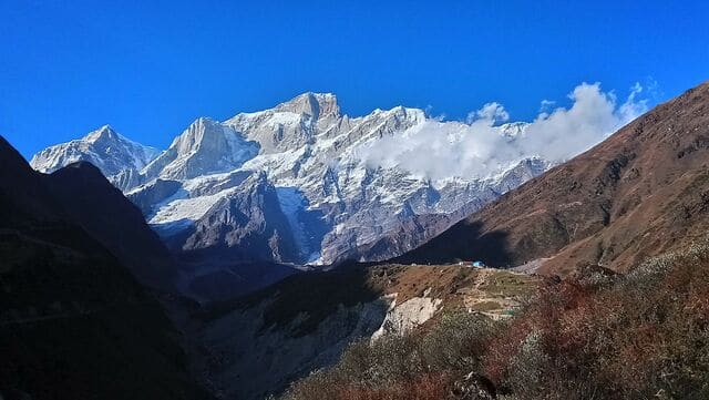
2. Kedarnath Peak and Kedarnath Dome
Kedarnath Peak and Kedarnath Dome are a part of the Gangotri group of peaks. The highest peak on the Southern Gangotri glacier is Kedarnath Peak, and the 3rd-highest is Kedarnath Dome.
Kedarnath Peak and Kedarnath Dome Height in Feet
The elevation of the Kedarnath peak is 22769 ft. Kedarnath Dome stands at 22411 ft.
Kedarnath Peak and Kedarnath Dome Expedition
The expedition to Kedarnath Peak and Kedarnath Dome takes 27-28 days (approx). It starts with arrival in Delhi, taking a train to Haridwar, and driving to Rishikesh. Then, a drive to Uttarkashi is taken, and the expeditors go towards Gangotri.
A trek follows it to Bhijbasa, Tapovan, and the Kirti Glacier base camp. The expedition begins by climbing the Kedarnath dome and then continues to the Kedarnath peak.
Kedarnath Peak and Kedarnath Dome Temperature
| Months | Min/Max temperature |
| April to June | 15-30 degrees |
| July to September | 12-27 degrees |
| October to March | 0-20 degrees |
Best time to Visti Kedarnath Peak and Kedarnath Dome
The best time for an expedition to Kedarnath Peak and Kedarnath Dome is mid-May to October.
Kedarnath Peak and Kedarnath Dome Base Camp Trek
The trek to Kedarnath Peak and the dome base camp takes 15 days (approx). Expeditors arrive in Delhi and drive towards Rishikesh via Haridwar. Then they move towards Uttarkashi (an 8-hour drive).
From Uttarkashi, trekkers drive to Gangotri via Harsil. On day 6, the journey from Gangotri to Bhoj Kharak starts. The trekkers visit Kedar Kharak and Kedar tal and back to Bhoj Kharak. Trekkers descend to Gangotri and move on to Bhojwassa and Gaumukh. Finally, they reach Tapovan and move on to the base camp.
How to reach Kedarnath Peak and Kedarnath Dome
The trek to Kedarnath Peak and Kedarnath Dome starts from Dehradun. A bus or taxi drops the trekkers off in Uttarkashi, and they continue to Gangotri, Bhojwassa, Gaumukh, and Tapovan. They finally reach the base camp, then head to the summit.
Kedarnath Peak and Kedarnath Dome Location
Kedarnath Peak and Dome lie in the Western Garhwal Himalayas, Uttarakhand, India. Kedarnath Peak is on the main ridge south of the Gangotri glacier. The dome (a sub-peak) lies 2 km northwest of the central peak on a spur projecting towards the Gangotri glacier.
Kedarnath Peak and Kedarnath Dome Climbing Cost
An expedition to Kedarnath peak and dome costs 2,00,000 INR (approx).
Packing List for Kedarnath Peak and Kedarnath Dome
- Backpack and day pack with rain cover
- Walking stick
- Head torch
- Water bottle
- First aid kit
- Sun and a woollen cap
- Balaclava and neck gaiters
- Sunglasses
- Trekking clothes and shoes
- Woollen and waterproof gloves
3. Nanda Devi Mountain
Nanda Devi is the second-highest mountain in Uttarakhand, India. The word “Nanda Devi” translates into “Bliss-Giving goddess.” Nanda Devi (the 23rd-highest in the world) is the patron goddess of Garhwal and Kumaon in the Himalayas. The Kumaon range of the Himalayas consists of the Nanda Devi peak.
Nanda Devi Height in Feet
The Nanda Devi peak is 25,643 ft high.
Nanda Devi Expedition
Nanda Devi’s expedition starts in Munsyari (a beautiful town). The route ascends to the Gauri Ganga river gorge, leading into a vast trans-Himalayan region. Himalayan settlements and villages like Burphu and Martoli were on the way.
This trek includes a walk to Nanda Devi’s base. The trail then heads North towards Milan village and the glacier. During this trek, many remote parts of the Himalayas and Nanda Devi’s central peak are closed for climbing.
Nanda Devi Peak Names
Nanda Devi is a massif comprising two peaks (western and eastern). The western or the main summit is higher than the eastern summit (Nanda Devi East). Locally, the main peak is called Nanda Devi, whereas the Nanda Devi East (eastern summit) is called Sunanda Devi.
Best time to visit Nanda Devi
The best time for the Nanda Devi trek is from May to June and September to October.
Nanda Devi Base Camp Trek
The trek to Nanda Devi base camp takes up to 10 days (approximately). It follows a circular trail that starts and ends at Munsiyari. Nanda Devi’s base camp offers trekkers a glimpse of many magnificent Himalayan peaks.
This trek takes you to the eastern side of the peak (home of Panchu glacier). It’s the closest point where the trekkers can admire the elegance of Nanda Devi’s main peak and Nanda Devi East.
How to reach Nanda Devi
Air, rail, and road transport can reach Nanda Devi’s peak quickly. Trekkers usually arrive at Kathgodam, which is well connected by road and rail. From here, the journey towards Munsiyari and the base camp begins. Delhi is the nearest international airport.
Nanda Devi Location
Nanda Devi, in Chamoli district, Uttarakhand, lies between the Rishiganga Valley (West) and the Goriganga Valley (East).
Nanda Devi Climbing Cost
The trek to Nanda Devi base camp costs 25,000 INR (approx). The trekking price for the Nanda Devi peak is $5000 (approx).
Nanda Devi Packing List for Trekking
- Duffle bag/rucksack
- A day backpack
- Sleeping bag
- Down jackets
- Sun hat
- Sunglasses
- Thick, warm, and waterproof gloves.
- Boots
- Binoculars
- Headlamp and extra batteries
- Trekking poles
- First aid kit
- Hiking garments for the upper and lower body parts
Note: It’s a consolidated list, perfect for any trek, hiking, or mountaineering.
4. Sandakphu Mountain Peak
Sandakphu Mountain is considered a trekker’s wonderland and the highest point in West Bengal. Mount Everest, Kanchenjunga, Makalu, and Lhotse are the four peaks connected to Sandakphu. The Sandakphu trail leads the trekkers through pine, oak, fir, and deodar forests.
Sandakphu Height
The height of this massive peak is 11930 feet (3,636 m).
Sandakphu Expedition
Sandakphu is the most famous trek in Eastern India, especially in West Bengal. This trek outlines the pristine beauty of nature. The Sandakphu tour is becoming more accessible due to improved roads.
The walk passes around Singalila Ridge, the most beautiful scenic point in the Himalayas. The Singalila National Park trail is a biodiversity hotspot for many plants and animals. Trekkers might be lucky to spot a Red Panda here.
Sandakphu Temperature
During winter, the temperature ranges from -11 degrees Celsius to 7 degrees Celsius. In the monsoon season, the air is fresh, and temperatures range from -5 to 15 degrees. Sandakphu receives little rainfall in the Spring, and temperatures range from -3 degrees to 10 degrees.
Best Time to Visit Sandakphu
Trekkers have eight months in a year to visit Sandakphu, excluding May and August, when the place receives rainfall.
Enjoy the snowy backdrop in winter. In spring, the peak is filled with various flora and fauna, like magnolias.
Sandakphu Base Camp Trek
Manebhanjan, in the Darjeeling district, is the base camp for the Sandakphu trek. It’s a small town at an elevation of 7,054 feet. From NJP and Bagdogra, Manebhanjan is a four-hour taxi drive. This route goes through Mirik.
If trekkers cannot find a cab, they must hire another car to reach Mirik. Trekkers reach Manebhanjan a day early and stay at a homestay or hotel. The next day, they proceed on their trek early in the morning.
How to reach Sandakphu
Trekkers reach Sandakphu either through NJP railway station or Bagdogra airport. Every day, multiple trains run from Kolkata to NJP. Usually, Trekkers take an overnight train and reach Chitrey (a small hamlet).
From there, the Sandakphu trail from Chitrey is 27 km. Traveller hires a shared vehicle from Darjeeling to Manebhanjan. It’s a one-hour drive (30 km) through Sukhiapokhri and Ghoom.
Sandakphu Location
Sandakphu peak is on the Singalila ridge. The Singalila Ridge is at the border of West Nepal and East India. It’s in the Darjeeling district of West Bengal, India. The Sandakphu trail runs zigzag between Nepal and India.
Sandakphu Climbing Cost
Sandakphu trek cost per person is approximately INR 10,000 (approx) for six days and five nights.
5. Anamudi Peak
Anamudi is Southern India’s highest peak, with dense evergreen trees and rivers. In colloquial language, “Anamudi” means “forehead of an elephant.” Being the highest in Western India, Anamudi is called “South India’s Everest.” The peak is in the subtropical zone and hence remains snow-free. The rare “Neelakurinji” flowers are found here.
Anamudi Height
Anamudi Peak is at an altitude of 8,842 feet (2,695 m).
Anamudi Expedition
The expedition to Anamudi Peak starts from Eravikulam. The trek takes about 2 to 3 days to complete, and it’s the most beautiful and challenging trail for visitors. Trekkers must ascend for 2 hours from Eravikulam National Park to reach the peak. The area has camping sites for travellers to enjoy the beautiful view during early mornings or late evenings.
Anamudi Temperature
The average temperature at Anamudi Peak ranges from 18 to 25 degrees Celsius.
Best Time to Visit Anamudi Peak
Visit Anamudi peaks in Spring and Winter (November to May). It’s the perfect time to explore the pick. The weather is mild, and a soothing breeze blows over the mountain.
The peak looks lush green during spring because of the foliage and flower bloom. Winter is the Ideal Time for trekking, as the hills are free of snow. Trekkers should avoid the monsoon season, as the trail becomes slippery.
How to reach Anamudi Peak
Trekkers usually hire a private car or local bus from Munnar to reach Eravikulam National Park. The journey takes 27 minutes (10.6 km). From the park’s entrance, trekkers regularly trek to Anamudi Peak.
Travellers hire a private cab and drive directly from Munnar to Anamudi Peak. The drive takes an hour.
To enjoy a relaxed trip, take a guided minibus tour of Eravikulam Park. The tour takes travellers to the closest viewpoint to the peak, where they can experience the scenic beauty of Anamudi and the surrounding mountains.
Anamudi Location
Anamudi lies on the border of Ernakulam, Devikulam, and Idukki in Kerala. The Anamudi peak is 13 km from Munnar and lies South of Eravikulam National Park.
Anamudi Climbing Cost
The entry fee for Eravikulam National Park is INR 125 (approximately) for Indians and INR 420 (approximately) (6 USD) for foreigners.
6. Mullayanagiri Peak
Mullayangiri Peak is the highest peak in Karnataka. A small temple at the summit of Mullayanagiri features a statue of Tapasavi Mullappa Swamy. According to legends, he meditated in a cave on the peak, giving the mountain its name. In Kannada literature, “Mullai” means forest, and Mullayangiri nestles between the Himalayas and Nilgiris.
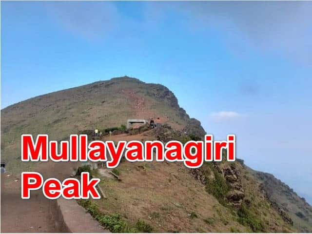
Mullayanagiri Height
The Mullayanagiri peak is 6330 feet (1,930 m) high.
Mullayanagiri Expedition
Sarpadhari bus stop is the starting point of the Mullayanagiri expedition. Prior permission from the Chikmagalur Forest Department is mandatory for the Mullayangiri trek, and the peak is accessible throughout the year.
The ascent is 60 degrees inclined and very steep. After 20 minutes on the trail, Mullayangiri becomes visible. The Sarpadhari stretch includes caves, streams, and the Nandi statue. Halfway to the top lies a mysterious cave with a flock of bats. The trail becomes less steep as trekkers approach Mullayanagiri Peak.
Mullayanagiri Temperature
The temperature at Mullayanagiri ranges between 20 degrees to 25 degrees Celsius.
Best Time to Visit Mullayanagiri Peak
The months from June to September are the best time to trek Mullayangiri Peak. The frequent rainfall during these months gives the hill a greener and more lively appearance. Trekkers are recommended to carry rain gear to enjoy their trek. Winters are also best, and the weather remains calm and pleasant. At night, the weather turns slightly chilly.
Mullayanagiri Base Camp Trek
Sarpadhari is the starting point or base camp for the Mullayangiri trek. “Sarpa” means snake, “Dhari” means path, and the Kannada word means “snake-like path.” It lies 15 km from Chikmagalur. An auto from Chikmagalur can drop trekkers to Sarpadhari for INR 300 (approx). The trek to Mullayanagiri Peak from Sarpadhari takes around 60 minutes.
How to reach Mullayanagiri Peak
Mangalore (180 km from Mullayanagiri) is the closest domestic airport. Bangalore International Airport is 287 km from Mullayanagiri. The Mullayanagiri trekking route can be reached by train.
Trekkers can reach either the Bangalore or Mangalore railway station. From there, they can go towards the Tarikere railhead, which is close to Mullayanagiri.
Chikmagalur (22 km from Mullayanagiri base) is linked via KSRTC buses, which run within the state.
Mullayanagiri Location
Mullayangiri is in the Chikmagalur district in Karnataka, 45 km from Chikmagalur. The peak forms part of the Budangiri range in the Western Ghats.
Mullayangiri Climbing Cost
Different providers offer different trekking experiences and costs to Mullayangiri. The climbing cost to Mullayangiri is, on average, INR 3000 (approximately) per head.
7. Kamet Mountain
Mt. Kamet is among the most glorious peaks in the world and the second-highest point in Uttarakhand. This peak is part of the Zaskar range and was first climbed in 1931. Kamet is inaccessible owing to its location near the Tibetan plateau. Tibetans call Mt. Kamet “Kang Med,” which means “burning mountain,” because of the falling sun’s rays.
Kamet Height
Mt. Kamet is 25,446 feet (7,756 m) high.
Mt Kamet Expedition
The Mt Kamet expedition starts from Niti Village and goes towards the base camp near Vasundhara Tal. Mana, Deoban and Ganesh Parbat are glimpsed en route to Mt Kamet. Trekkers find glacial lakes, barren land and large boulders and rocks throughout the trek. The summit is ascended from its northern edge, which lies across deep crevasses. It takes approximately a month to complete the whole tour.
Mt Kamet Temperature
The average temperature at Mt. Kamet is 5 to 10 degrees Celsius, but it can drop to -2 to -15 degrees Celsius.
Best Time to Visit Mt Kamet
May, June, September and October are the best times to visit Mt. Kamet.
Kamet Base Camp Trek
Vasundhara Tal is the base camp for the Mt. Kamet expedition. It’s an attractive glacial lake that remains completely frozen. Small lakes and ponds surround this region.
The trek to base camp is challenging and surrounded by tall Himalayan mountains. The Mt. Kamet trail goes through a beautiful, quaint village at an altitude of 3,450 m. Vasundhara Tal trek is the most beautiful trek in the Garhwal Himalayas.
How to reach Mt. Kamet
Roads from Rishikesh, Dehradun, and Haridwar connect Joshimath (the nearest town). Trekkers reach Rishikesh, Dehradun, and Haridwar from Delhi, then take a bus or shared cab to Joshimath.
The nearest railway station to Joshimath is in Haridwar. The nearest airport is Jolly Grant in Dehradun.
Kamet Location
Mt. Kamet lies at the meeting point of India, Tibet, and Nepal. Its peak is in the Chamoli district of the Garhwal Himalayas.
Kamet Climbing Cost
The expedition cost of Mt. Kamet is $8000-10,000 (approx) per person.
8. Trisul Peak or Trishul Mountain
The Trishul Peak comprises three Himalayan mountains, which resemble a trident. This group of peaks encloses Nanda Devi Sanctuary from the South-East, forming a ring. Trishul was the first peak to be climbed by a human in 1907. Trekkers can glimpse Trishul Mountain from Kausani (Roopkund Trek).
Trishul Mountain Height
Trishul Mountain stands tall at 23,360 feet (7120 m).
Trishul Expedition
The trek to Mt. Trishul is challenging and requires technical knowledge and skill. The Trishul trek starts from Sutol village. The trail passes through pretty meadows surrounded by snow-covered peaks.
While trekking, trekkers cross small water streams to reach the peak. Climbers spot Himalayan Musk deer while trekking to Mt. Trishul, which takes approximately 27 days.
Trishul Mountain Peak Names
Mt. Trishul comprises three peaks that form the trident shape. The three peaks are named Trishul I, Trishul II and Trishul III. Trishul I is the highest (7,120 m), followed by Trishul II (6,690 m) and finally Trishul III (6,007 m).
Trishul Mountain Temperature
The weather remains cold, with heavy snowfall during Spring (March and April). During the monsoon, the temperature falls further. Trekkers witness pleasant weather and clear skies in September, October and November. Mt. Trishul receives its first snowfall in November or December.
Best Time to Visit Trishul Mountain
July, August and September are the best months to trek Mt. Trishul.
Trishul Mountain Base Camp Trek
Homkund is the base for the Trishul Mountain trek. The first five days of the trek are dedicated to reaching the base camp. Trekkers pass through Tatara village and Latakopri to reach Homkund. The trek to Mt. Trishul base camp is a favourite of nature lovers. The base camp trail passes through meadows and water streams.
How to reach Trishul Mountain
Kausani is the nearest hill station to Mt. Trishul in Bageshwar district, Uttarakhand. The Kumaon region of Uttarakhand is connected to towns and cities via Kausani. Trekkers take a bus or a cab from Kathgodam (Kumaon Hill transport junction) to reach Kausani.
Ramnagar railway station is the closest to Kausani and can be reached by bus, cab, or other transport. The nearest airport is Pantnagar Airport (219 km).
Trishul Mountain Location
The three Himalayan peaks, Trishul, lie in Uttarakhand’s Bageshwar district.
Trishul Mountain Climbing Cost
The climbing cost to Mt. Trishul is 9000-10,000 INR (approx).
9. Kalsubai Peak
Kalsubai Peak in the Sahyadri range is the highest peak in Maharashtra, known as the “Everest of Maharashtra.” According to legend, a girl named Kalsu did household work for a local family.
An elder of the house abused her, and she climbed the peak and stayed there till her death. Kalsu became the region’s guardian deity. A temple was built in her honour, and the mountain “Kalsubai” was named after her. Trekkers end their trek after reaching this temple.
Kalsubai Mountain Height
The height of the Kalsubai summit is 5400 feet (1646 m).
Kalsubai Mountain Expedition
The Kalsubai expedition is moderately complex. The trail goes through paddy fields, jungle, rocky terrain, highlands and small streams. Trekkers take 4-5 hours to reach the summit.
Three artificial stairs are built on the peak for visitors who don’t want to trek. After climbing the first two ladders, a small plateau is reached, and the third ladder leads to the summit of Mt. Kalsubai.
Kalsubai Mountain Temperature
A hot semi-arid climate prevails at Kalsubai all around the year. The average temperature ranges from 19 degrees to 33 degrees Celsius. April and May are the hottest months, with temperatures rising to 42 degrees.
Winters are chilly, with temperatures falling to 10 degrees at night and 26 degrees during the day.
Best time to visit Kalsubai Peak
Kalsubai Peak is best visited during the winter and monsoon seasons. Trekkers stand on the peak and see clouds passing under their feet. During the monsoon (July to October), heavy rain gives the place a green appearance.
The Winter season (October to March) is equally breathtaking. Climbing the peak during cosy winters is an excellent form of exercise.
Kalsubai Mountain Base Camp Trek
The base of the trek is Bari village, at the foothills of Kalsubai. Trekkers reach the village and cross a small stream to a Hanuman temple. The route from the Hanuman temple goes straight to Kalsubai Peak.
The trail is well-marked to prevent trekkers from getting lost. Climbers can even take the three stairs to reach the Kalsubai summit.
How to reach Kalsubai Mountain
Igatpuri is the nearest railway station (19 miles) from Bari village (the base for the trek). Trekkers take a cab from Igatpuri station and reach the base village in about 60 minutes.
Kasara railway station is 50 km away, and Nasik City lies 60 km from Bari. The base village (Bari village) can also be reached by road from Mumbai.
Kalsubai Mountain Location
The Kalsubai Peak of the Western Ghats is in Maharashtra, India. It lies in the Ahmednagar district and Akola Taluka, at the border of Nashik and Ahmednagar.
Kalsubai Mountain Climbing Cost
INR 1350 per person (approx) is the climbing cost to Kalsubai Peak.
10. Deomali Mountain
Deomali Peak in the Eastern Ghats is Odisha’s highest peak. The peak, near Doodhari village, is surrounded by lush green forest. Minerals like bauxite, limestone, and gemstones are abundant on the hill.
Deomali is inhabited by the Parajas, Kandhas, Malis, Bhotras, and Bhumia tribes. Tourists can enjoy hang gliding, trekking and mountaineering on Deomali Peak.
Deomali Mountain Height
Deomali peak is elevated at 5486 feet (1672 m).
Deomali Mountain Expedition
Tourists travel through the well-constructed road to reach the top of the valley. From there, they trek to the summit. While trekking, peak trekkers encounter various rare plants and trees.
You can spot hyenas, wolves, deer, foxes and bears on the trail. The mountain top is flat, making it perfect for a family trip. Trekkers can light a fire, set up a tent and enjoy astonishing views from the mountain.
Best Time to Visit Deomali Mountain
Monsoon and winter are the ideal seasons for visiting Deomali Mountain. During the monsoon, trekkers enjoy breathtaking views of clouds below the valley. The skies are clear in winter, perfect for stargazing and enjoying a crimson-hued sunset.
How to reach Deomali Mountain
Koraput is the nearest town to Deomali (35 km). Tourists take buses to reach Koraput via the National Highway, and the Koraput railway station is the closest rail junction to Deomali. Tourists can hire private cabs to move around Odisha.
Deomali Mountain Location
The peak is near Koraput in the Koraput district of Southern Odisha. Deomali lies in the Chandragiri-Pottangi sub-range of the Eastern Ghats.
11. Meesapulimala Peak
Meesapulimala is the second-highest peak in Kerala and the most popular trekking destination. The mountain is called “Meesapulimala” because it has eight peaks shaped like moustaches.
Kerala Forest Department Corporation (KFDC) organises the trek to the peak via the Rhodo Valley. While trekking, one can see animals like Sambar Deer, Wild Gaur, Nilgiri Thar, and Sloth Bear.
Meesapulimala Peak height
Meesapulimala is at an elevation of 8,724 feet (2,659 m).
Meesapulimala Expedition
KFDC provides camping and trekking packages to Meesapulimala. During their trek, trekkers enjoy the lush green valley, beautiful Rhododendrons, brooks, and tea estates.
The trail passes through eight peaks that mark the border between Tamil Nadu and Kerala. The Meesapulimala trekking trail ranges from easy to moderate, so trekkers of all ages can complete it without hindrance.
Meesapulimala Temperature
The average temperature of the Meesapulimala peak is 19.4 degrees Celsius. On average, the hills receive 2640 mm of precipitation.
Best Time to Visit Messapulimala
Winter (October to February) is the most preferred time to visit Meesapulimala Peak. After the monsoon, the entire region looks green and beautiful. During these months, trekkers enjoy birds singing, calm wind and rushing waters. Trekking to Meesapulimala in winter is comfortable.
Meesapulimala Base Camp Trek
The base camp of the Meesapulimala trek is in Munnar, at an elevation of 6000 feet. Munnar is famous for Neelakurinji flowers, which bloom once every 12 years. KFDC allows only 40 people to stay at the base camp for a night. Meesapulimala trekking packages by KFDC include breakfast, lunch, a guide, evening tea, and dinner.
How to reach Meesapulimala
Trekkers reach Meesapulimala from the base camp (Munnar), 42 km from the City centre. The trip to the base camp via the Suryanelli-Kolukkumalai tea estate takes approximately 3 hours.
Kottayam is the closest railhead to Munnar. Cochin International Airport is 6 hours away, and Madurai International Airport is 4 hours away.
Meesapulimala Location
In the Western Ghats, Meesapulimala is in the Idukki district in Kerala.
Meesapulimala Climbing Cost
The climbing cost to Meesapulimala is INR 3000 (approx) per person.
12. Parasnath Hill
The Parasnath range is the highest peak in Jharkhand. An important pilgrimage site for Jains, Parasnath is named after the 23rd Tirthankara. 22 out of 24 Jain Tirthankaras attained salvation on the summit of Parasnath.
There is a shrine for 9 Jain Tirthankara at the peak. Temples on the Parasnath peak are older than 2000 years. Santhals call the mountain “Marang” (hill of deity). They celebrate the hunting festival on a full moon day (mid-April).
Parasnath Hill Height
Parasnath Hill stands at an elevation of 4,403 feet (1,342 m).
Parasnath Hill Expedition
Parasnath Hill, or Shikarji, is a pilgrimage trek. The top of the hill offers a mesmerising sunrise view. Devotees undertake the tour without drinking or eating. There are two cemented trails for the Parasnath trek.
The first trail is 27 km and circles the 26 temples on the summit; another is 18 km (9 km up and 9 km down). After climbing 6 km, trekkers spot two mini waterfalls deep in the forest.
Best Time to Visit Parasnath Hill
October to March is the most preferred time to visit this holy site. The weather is pleasant then, neither hot nor cold, with no rain.
Parasnath Hill Base Camp Trek
For the Parasnath Pilgrimage, the base camp lies in Madhuban. The tiny town of Madhuban in Giridih is dotted with many Jain temples. Madhuban has two trekking trails that lead to the summit of Parasnath.
Local villagers use the southern trail, and the northern route is abundant with tourist amenities. Every year, devotees circumambulate the base to show their religious endeavour. The path beyond Gandharva Nala (gurgling stream), 4 km from the ground, is sacred to the devotees.
How to reach Parasnath Hill
Trekkers reach Parasnath railway station and take a taxi to Madhuban (base village). Parasnath is a 6-hour train journey from Kolkata. Ranchi Airport is the closest airport to Parasnath Peak. Bokaro Steel City is 54 km away, and Hazaribagh is 38 km away from Parasnath Hill.
Parasnath Hill Location
Parasnath Hill lies in the Giridih district in Jharkhand, India.
13. Kodachadri Mountain
Kodachadri Mountain in the Western Ghats is a natural heritage site and provides a beautiful backdrop for Kollur Mookambika Temple.
The word “Kodachadri” comes from the Sanskrit word “Kutaja”, meaning “Jasmine of hills”. Adi Shankara, the famous philosopher, visited and meditated at the summit.
Kodachadri Mountain Height
Kodachadri Mountain is 4,406 feet (1,343 m) above sea level.
Kodachadri Mountain Expedition
Kodachadri’s trekkers pass paddy fields, quaint villages, grasslands, thick forests, and waterfalls. To reach the summit, they trek for 5 hours. The Kodachadri trekking trail passes through Mookamnika Wildlife Sanctuary.
The western side of the mountain is steep at 1220 m. Then, it meets the forest in the Udupi district. Trekkers trek for 4 km via the thick forest to reach an ancient temple.
Kodachadri Mountain Temperature
The average temperature in summer (March to May) lies between 25 degrees to 35 degrees Celsius. Kodachadri Mountain gets heavy rain from June to August. Winters (September to February) are chilly, and winter temperatures are between 15 degrees to 20 degrees Celsius.
Best Time to Visit Kodachadri Mountain
The charm of Kodachadri Mountain attracts visitors all year round. However, the preferred time to visit the hill is after the monsoon. After heavy rain, the landscape looks green and lively.
Kodachadri Mountain Base Camp Trek
There are three base villages for the Kodachadri trek. Travellers can walk from Vallur, Nittur or Kattinahole. A trail from Vallur is more accessible than the other two.
Trekkers hire private vehicles to reach the summit (4-5 hours). Moola Mukambika Temple is the meeting point for all three trekking trails. The trek to the summit is about 2 km from the temple.
How to reach Kodachadri Mountain
Kollur lies 20 km from Kodachadri mountain and is connected to important cities like Chennai, Bangalore and Mumbai via bus. By road, the distance from Bangalore to Kodachadri is 400 km. Kundapura, 50 km from Kollur, is the closest railhead, and Mangalore (150 km) is the nearest airport.
Kodachadri Mountain Location
Kodachadri (or Kudajadri) is a mountain in the Shimoga district of Karnataka, India.
Kodachadri Mountain Climbing Cost
INR 3000 (approx.) per person is the cost of climbing Kodachadri Mountain.
14. Nag Tibba Peak
Nag Tibba, or Serpent’s Peak near Mussoorie, is the tallest peak in the Garhwal region. It was named after “Nag Devta.” There is a small temple on the summit. From the peak, trekkers glimpse the whole Banderpunch towards Yamunotri. Nag Tibba is a popular weekend trek in India due to its easy trail.
Nag Tibba Peak Height
Nag Tibba Peak stands tall at 9915 feet (3022 m).
Nag Tibba Peak Expedition
The circular Nag Tibba trek route offers contrasting panoramas. The trail passes through dense oak forests, cedar forests, alpine forests, rhododendrons, etc. The Nag Tibba trek starts from Pantwari (a small hamlet) and goes up a rocky path. Trekkers camp amidst thick forests and meadows and enjoy bird-watching on the summit.
The Nag Tibba summit offers views of massive peaks like Srikanth, Black Peak, Gangotri, Doon Valley, Kedarnath (north), Banderpunch, Swargarohini, and Chanabang.
Nag Tibba Peak Temperature
From September to December, the average temperature ranges between 14 to 22 degrees Celsius (during the day) and drops to 6 and 14 degrees Celsius during the night.
During other months (January-August), the temperature ranges from 16 to 5 degrees Celsius (during the day) and from 8 to 16 degrees Celsius (at night).
Best Time to Visit Nag Tibba Peak
Nag Tibba is a popular trekking destination year-round. The two best seasons for trekking are summer and winter. During summer (April-June), the weather remains pleasant, and if trekkers want to enjoy chilly weather, trekking in October-December (winter) is ideal.
Nag Tibba Peak Base Camp Trek
Nag Tibba base camp lies at an elevation of 2600 m and features a temple dedicated to the serpent god. From Mussoorie, trekkers reach Pantwari (60 km), the trek’s starting point. The trek to Nag Tibba base camp from Pantwari (7 km) takes 5 hours (approximately).
How to reach Nag Tibba Peak
Jolly Grant Airport in Dehradun is the closest to Mussoorie (60 km). Trekkers take an overnight train from Delhi to Dehradun, and Mussoorie is 33 km away from the Dehradun railhead.
Bus services to Dehradun from Delhi are regularly available, and TTH’s Tata Sumo picks up trekkers from the Dehradun railhead at 6:30 a.m.
Nag Tibba Peak Location
Near the Lesser Himalayas, Nag Tibba Peak lies in Uttarakhand, India.
Nag Tibba Peak Climbing Cost
The cost of climbing Nag Tibba is INR 4000 per person (approx).
15. Doddabetta Mountain
Doddabetta, 10 km away from Ooty, is the highest peak of the Nilgiris. “Dodda” means Big, and “Betta” means the mountain. The word “Doddabetta” means “Big Mountain”; it’s a haven for trekkers. This place offers a spectacular viewpoint comprising herbs and rhododendrons.
Doddabetta Mountain Height
Doddabetta stands tall at a great elevation of 8652 feet (2637 m).
Doddabetta Mountain Expedition
The trail to Peak Doddabetta is approximately 3 km long. Trekkers travel via grassy slopes filled with alpines and ferns and rugged paths. Doddabetta Trek is perfect for people who love lush greenery and a relaxing ambience.
Trekkers glimpse Bandipur National Park and Ooty’s skyline from the telescope on Mt. Doddabetta. Travellers can find a telescope house on the peak’s summit.
Dodabbetta Mountain Temperature
Doddabetta experiences a relatively mild climate year-round. Summers are pleasant, with the average temperature ranging between 10 degrees to 21 degrees Celsius. Winters are chilly, and temperatures remain between 5 to 21 degrees Celsius.
Best Time to Visit Doddabetta Mountain
October to January is considered the most favourable time for trekking Mt. Doddabetta. To avoid crowds, visitors prefer trekking early in the morning. Trekkers can travel to the summit from 9:00 am to 6:30 pm daily.
Doddabetta Mountain Base Camp Trek
Ooty, the starting point of the Doddabetta trek, serves as a base camp. The trail varies in difficulty level and is suitable for beginners and professionals. Trekkers glimpse the picturesque Nilgiris, green forests, waterfalls, and small streams. From Ooty City Centre, the trail to Doddabetta Peak is 9 km.
How to reach Doddabetta Mountain
Car and bus access to Doddabetta. From Ooty City Centre, the trail to Doddabetta Peak is 9 km; from Ooty bus stand, It is 8 km. Trekkers reach Kottagiri to reach the summit, and the Doddabetta Tea factory falls in the way.
Ketti railhead (14 km) is the closest to Doddabetta Peak. Mettupalayam railhead, Ooty, is connected to the Nilgiri Mountain Railway toy train. Coimbatore (95.5 km) is the nearest airport to reach Doddabetta.
Doddabetta Mountain Location
Doddabetta Summit in the district of Nilgiri (Tamil Nadu) is 9 km from Ooty.
Doddabetta Climbing Cost
The entry fee for Doddabetta Peak is 10 rupees, or 0.14 USD per person (approx).
16. Chandrashila Mountain
Chandrashila means “Moon Rock.” It is the summit of Mt. Chandranath, which houses the Tungnath temple dedicated to Panch Kedar. The summit offers a panoramic view of the Great Himalayas.
It is said that after defeating Ravana, Lord Lakshman meditated on the Chandrashila summit. The moon-god Chandra also completed his penance on the peak.
Chandrashila Mountain Height
Chandrashila Peak stands tall, 12,110 feet (3690 m).
Chandrashila Mountain Expedition
In India, the Chandrashila trek is the best winter trek. The trail to Chandrashila takes visitors to the summit via Sari, Chopta, and Rishikesh. It passes under the canopy of an oak tree, soft snow, and beautiful rhododendron trees.
Chandrashila Peak offers a view of over 200 species of flora and fauna. You can spot musk deer and rare bird species. Trekkers enjoy the presence of a golden-breasted eagle from the peak.
Chandrashila Mountain Temperature
The temperature ranges from 8 to 15 degrees Celsius during the day and from -5 to 3 degrees Celsius at night.
Best Time to Visit Chandrashila Mountain
We can undertake the trek to Chandrashila for 8 months of the year. The best seasons to hike the summit are Autumn (September-November), Spring (March-April) and Summer (May-July). During winter (December), snow-covered roads get cut off from the summit.
Chandrashila Mountain Base Camp trek
Sari (6600 feet) is the base camp for the Chandrashila trek. It’s inthe Rudraprayag district (8 hours) from Haridwar. Many homestays, guest houses, and campsites are available at the picturesque base camp (Sari) of Chandrashila Mountain.
How to reach Chandrashila Mountain
Jolly Grant is the closest airport to Dehradun. By private vehicle, trekkers take 6.5 hours (211 km) to reach Sari from the airport.
The closest railhead, Haridwar, is connected to major cities. Trekkers hire local cabs and buses to reach Sari from Haridwar. Private & government buses and cabs drop visitors at Chopta from Haridwar in about 8 hours (200 km).
Chandrashila Mountain Location
Chandrashila Peak in the Garhwal range lies in Uttarakhand, India.
Chandrashila Mountain Climbing Cost
The trek to Chandrashila Mountain costs INR 9000 per person (approx.).
17. Guru Shikhar Peak
Guru Shikhar is the tallest mountain in the Aravali range. It is 15 km from Mount Abu and houses the famous Mount Abu Observatory. Guru Shikhar translates into “peak of the guru.” Guru Dattatreya lived here as a monk, and the authority built a cave and a temple in his memory.
Guru Shikhar Peak Height
Guru Shikhar Peak stands tall at 5650 feet (1722 m).
Guru Shikhar Peak Expedition
Trekking to the summit of Guru Shikhar offers a panoramic view of the Aravalli Range and the town of Mount Abu. After climbing 300 steps from the base, trekkers reach the peak’s summit.
The climb is steep, but the well-maintained steps make it easy for visitors. Guru Shikhar Peak is open to travellers from 8 a.m. to 6:30 p.m.
Guru Shikhar Peak Temperature
| Months | Minimum Temperature (degrees Celsius) | Maximum Temperature (degrees Celsius) |
| January | 10 | 30 |
| February | 11 | 36 |
| March | 13 | 41 |
| April | 17 | 40 |
| May | 18 | 33 |
| June | 18 | 34 |
| July | 18 | 34 |
| August | 25 | 33 |
| September | 23 | 35 |
| October | 18 | 36 |
| November | 15 | 35 |
| December | 13 | 31 |
Best Time to Visit Guru Shikhar Peak
Guru Shikhar is a peak on Mount Abu in Rajasthan. Owing to its pleasant weather, trekkers can visit Guru Shikhar throughout the year. Summers are the best time to visit if you leave behind the scorching heat and enjoy the chilly winds. It’s advisable to avoid the rainy season, as the trekking trails get slippery.
How to reach Guru Shikhar Peak
Highways connect Mount Abu to significant cities by road. NH-14 (24 km) is the closest highway to Mount Abu.
Cities like Delhi, Ahmedabad, Jaipur, and Mumbai are well connected to Mount Abu via rail. The closest railhead is Abu Road station, 28 km from the central city. Trekkers can hire cabs from the station or use state transport services.
The closest airport is Udaipur, 185 km from Mount Abu. For better connectivity, trekkers prefer to fly into Ahmedabad Airport, 221 km from Mount Abu.
Guru Shikhar Peak Location
Guru Shikhar Peak is a popular tourist attraction in Rajasthan, India.
Guru Shikhar Peak Climbing Cost
The trekking packages to Guru Shikhar Peak start at INR 5000 per person (approx).
18. Pushpagiri Mountain
Pushpagiri Mountain, or Kumara Parvatha, is Karnataka’s sixth-highest mountain. The hill has jagged terrain, with misty grassland and lush green forest. River Harangi originates at the summit of Pushpagiri, and Kumara Parvatha offers a pleasant hiking experience for trekkers.
Pushpagiri Mountain Height
Pushpagiri Mountain is at an elevation of 5,617 feet (1712 m).
Pushpagiri Mountain Expedition
The Pushpagiri trek’s difficulty level ranges from easy to medium. The hike starts at the forest checkpoint. From the checkpoint (after Heggadamane village), travellers can reach the Pushpagiri summit in 4 or 5 hours (7 km). The Kumara Parvatha trail traverses rocky terrain and wet meadows amid thick forests.
Camping at the peak is prohibited. However, with the forest department’s permission, we can go camping at designated sites.
Pushpagiri Mountain Temperature
The coldest months are November to January, with average daytime temperatures between 7 and 20 degrees Celsius. April and May are the hottest months, with temperatures increasing to 29 degrees Celsius.
Pushpagiri receives heavy rainfall from June to September, and the area is completely covered in mist from October to December.
Best Time to Visit Pushpagiri Mountain
The best time to visit Pushpagiri Mountain or Kumara Parvatha is from October to May, after the monsoon period. During these months, trekkers enjoy mesmerising views from the peak, and the cool mist at the top makes the trek worthwhile.
Pushpagiri Mountain Base Camp
Kukke Subramanya, a temple built to commemorate Kumara Swamy, serves as the base camp for the trek. Bhagati also serves as a base camp for the Pushpagiri trek. The peak is 10 km (3 hours) from Bhagati.
How to Reach Pushpagiri Mountain
The closest airports to Kukke Subramanya (base camp) are Bengaluru (280 km) and Mangaluru (105 km). From Bengaluru to Mangaluru, a limited bus service is available to reach Kukke Subramanya (base camp). Subramanya railhead is the closest railway station to the base (12 km).
Pushpagiri Mountain Location
Kodagu district in Karnataka is home to the second-tallest hill in Coorg, Pushpagiri Mountain, also known as Kumara Parvatha.
Pushpagiri Mountain Trek Cost
The trek to Pushpagiri Mountain in Coorg costs around INR 1100 (approx) per person.
19. Agasthyamalai Hills or Agastya Mala
Agasthyamalai, Agastya Mala, or Agasthyakoodam are among Kerala’s highest peaks. Agasthya Mala, a famous pilgrimage site, is named after the sage Agastya. The hill is renowned among birdwatchers for its many exotic avian species.
Agasthyamalai has over 2000 orchids, ferns, medicinal herbs, lichens, mosses, and other plants. It’s believed that even the air on the peak has medicinal value.
Agastya Mala Hill Height
Agasthya Mala is at an elevation of 6,129 feet (1868 m).
Agastya Mala Hill Trek
The Forest Department of Kerala protects Agastya Mala Peak and its surrounding areas. Entry to the peak is restricted. The Forest Department organises a pilgrimage every year from January to March.
The Makaravilakku festival at the Sabarimala temple marks the start of the trek, which ends on the day of Sivarathri. The Agasthyamalai trek is available for only 60 days, and they issue just 100 passes each year on a first-come, first-served basis.
You can book Agastya Mala trek tickets online from the official website of the Forest Department of Kerala. The ticket costs INR 600 (approximately). A single ticket can accommodate up to 15 people. Information such as name, age, identity proof, address, and contact details is required for booking.
Agastya Mala Hill Temperature
The monsoon influences its location in the Western Ghats. Summer (April to July) is warm and humid, with rainfall from the southwest monsoon. The temperature can reach 35 degrees Celsius.
The Winter months (October to January) are dry and cool, with temperatures falling below 16 degrees Celsius. Northeast monsoon winds bring winter rainfall in October and November.
Agastya Mala Hill Base Camp Trek
Athirumala has a base camp on the Western Valley peak. From Bonacaud (starting point), Athirumala is 15 km away, and the peak is 5 km away. After completing a vertical climb to Athirumala via the evergreen forest, trekkers glimpse the majestic Agastyakoodam hill. Before the commencement of the trek, the forest in charge verifies the entry pass of all trekkers.
How to Reach Agastya Mala Hill
Kerala and Tamil Nadu share the Agastya Mala peak and thus are connected via road from both states. Thiruvananthapuram Central bus station is the nearest bus stop.
Buses drop the trekkers at Bonacaud town, 15 minutes from the Agastya Mala Biosphere Reserve forest office. Ambasamudram (Tamil Nadu) and Thiruvananthapuram (Kerala) are the closest railheads. The nearest airport in Thiruvananthapuram is connected to other cities in India.
Agastya Mala Location
The Agastya Mala Peak is in Kerala and Tamil Nadu, part of the Western Ghats mountain range. The peak forms a part of the Agastya Mala Biosphere Reserve and the Neyyar Wildlife Sanctuary.
Agastya Mala Trek Cost
The Kerala Forest Department’s trip to Agastya Mala peak costs around INR 600 (approximately). Opting for a private trek will cost INR 4000 to 6000 (approximately).
20. Chaukhamba Mountain
Chaukhamba is a vast mountain in the form of four pillars in the Garhwal Himalaya’s Gangotri range. It’s a group of four mountains, with Chaukhamba I being the tallest. The peak’s prominent location and adventure activities attract explorers.
Chaukhamba Mountain Height
The Chaukhamba Mountain is 23,419 feet (7,138 m) high.
Chaukhamba Mountain Expedition
The trek to Chaukhamba is challenging, and many attempts have failed in the early stages. In 1952, Lucien George and Victor Russenberger were the first mountaineers to climb Chaukhamba.
From Badrinath in Uttarakhand’s Chamoli district, the Chaukhamba peak trek begins. Trekkers can choose from four trekking routes: west face, northwest ridge, northeast face, and southwest face.
Chaukhamba Mountain Peak Names
| Peak Names | Height |
| Chaukhamba I | 23,419 feet (7,138 m) |
| Chaukhamba II | 23,196 feet (7,070 m) |
| Chaukhamba III | 22,949 feet (6,995 m) |
| Chaukhamba IV | 22,487 feet (6,854 m) |
Best Time to Visit Chaukhamba Mountain
June to September are the best months for mountaineers to climb Chaukhamba Mountain. Out of four peaks, Chaukhamba I is an open peak. The best time to visit Chaukhamba I is from April to October.
How to Reach Chaukhamba Mountain
Badrinath is the starting point for the Chaukhamba trek. Rishikesh, Dehradun, and Haridwar are well connected to Badrinath via road. Trekkers reach Rishikesh, Dehradun or Haridwar and take a cab to Badrinath.
There is no railhead in Badrinath. Haridwar is the closest railhead, connected to Ahmedabad, Delhi, and Dehradun. The Jolly Grant Airport is the nearest airport to Badrinath. Trekkers board a bus or a cab from the airport to reach Badrinath.
Chaukhamba Mountain Location
Chaukhamba mountain of the Garhwal Himalaya’s Gangotri group lies in Uttarakhand, India.
21. Dhupgarh Hill
Dhupgarh, the tallest peak of the Satpura range, is Central India’s only hill station. It’s a popular tourist destination in Pachmarhi (a hill town). Dhupgarh derives its name from the abundant sunlight it receives. The hill offers mesmerising sunrise and sunset views for trekkers.
Dhupgarh Hill Height
Dhupgarh Hill in Madhya Pradesh is 4,429 feet (1,350 m) above sea level.
Dhupgarh Hill Expedition
The route to the peak of Dhupgarh is filled with rough scraps, ravines, and clefts. Trekkers take 2 to 3 hours to reach the summit. We can spot the Vindhya and the lesser Satpura range from the peak.
Dhupgarh Hill is a perfect destination for hiking, camping, rock climbing, and trekking. It’s an ideal place to spend quality time away from the hustle and bustle of the city.
Best Time to Visit Dhupgarh Hill
Dhupgarh Hill in Pachmarhi is a popular tourist attraction. It can be visited at any time or season.
How to Reach Dhupgarh Hill
Pachmarhi is well connected by road and rail. Pipariya railhead is the closest railway station, and Bhopal airport is the nearest airport. Tourists reach Dhupgarh village by boarding public or private transport. From Dhupgarh village, the trek to the hilltop is short and takes around 2-3 hours.
Dhupgarh Hill Location
Dhupgarh Hill is in Pachmarhi Hill in Madhya Pradesh, India.
22. Neelkanth Peak
Neelkanth Peak, also known as “Garhwal Queen,” is pyramidal. The snow-clad mountain shines golden when the sun’s rays fall on it at sunrise. During sunset, Neelkanth looks red, like a ruby crystal. According to legends, Neelkanth Peak is Lord Shiva standing between Kedarnath and Badrinath to block the routes to both places.
Neelkanth Peak Height
Neelkanth Peak stands tall at 21,300 feet (6500 m).
Neelkanth Peak Expedition
The trek to Neelkanth Peak (10 km) begins from Badrinath. Trekkers reach Charan Paduka (3 km) to glimpse Lord Vishnu’s footprints and Rishi Ganga falls. The journey from Charan Paduka to Neelkanth Base Camp (6 km) is challenging, and the base camp offers mesmerising views of the peak.
After reaching the base camp, trekkers proceed toward the summit. The Neelkanth trek takes 2 to 3 days to complete. Three climbing routes lead to the summit: the west ridge, the north face, and the northeast ridge.
Best Time to Visit Neelkanth Peak
July to September is the ideal time to visit Neelkanth Peak. During these months, the sacred Brahmakamal flowers bloom everywhere.
Neelkanth Peak Base Camp Trek
Neelkanth peak trek begins from Badrinath Ji (base camp). Because of many religious beliefs and myths, it’s an essential and sacred destination for Hindus. The Neelkanth trek’s base camp is reached in 2 to 3 days. After climbing the first 3 kilometres, the difficulty level increases. The Neelkanth Summit and the Nanda Devi Peak are visible from the base camp.
The permit to the Neelkanth base camp is given to people who pass the mental and physical fitness exam. Trekking to base camp is prohibited if you suffer from heart problems, diabetes, or asthma.
How to Reach Neelkanth Peak
Start the Neelkanth trek from Badrinath. Rishikesh, Dehradun, and Haridwar are well connected to Badrinath via road. Trekkers reach Rishikesh, Dehradun or Haridwar and take a cab to Badrinath.
Haridwar is the closest railhead to Badrinath, connected to Ahmedabad, Delhi and Dehradun. Badrinath’s nearest airport is the Jolly Grant. Trekkers board a bus or a cab from the airport to reach Badrinath.
Neelkanth Peak Location
Neelkanth Peak is situated in the Chamoli district of Uttarakhand, India.
23. Satopanth or Satopanth Tal Glacier
Mount Satopanth is the second-highest peak of the Gangotri group. Satopanth means “True Pathway to Heaven.” The trek to Mount Satopanth is perfect for climbers who aspire to climb above 8000 m, preferably Mount Everest. From Mount Satopanth, climbers can view mesmerising views of Gangotri, Bhagirathi, and other Himalayan peaks.
Mount Satopanth Height
Mount Satopanth in Uttarakhand is 23,212 feet (7075 m) high.
Mount Satopanth Expedition
The massive peak of Satopanth attracts climbers who want to push their limits. The trek to Mount Satopanth Peak traverses high, steeply angled slopes and complex glaciers. Climbers go through a knife-edge route before approaching the summit. The expedition requires technical knowledge and proper equipment, including crampons, ropes, and ice axes.
The Mount Satopanth trek takes climbers through the banks of the River Ganga, the River Bhagirathi, Gangotri, and Gaumukh. Only aspirants who are physically and mentally fit can climb the complex terrain and unpredictable weather of Mount Satopanth.
From Gangotri to the base camp of Vasuki Tal
The average daytime temperature is between 5 and 10 degrees Celsius, and at night it ranges from -2 to 6 degrees Celsius.
From the base camp of Vasuki Tal to Satopanth summit
During the day, the temperature ranges from -2 degrees to 5 degrees Celsius. The average temperature at night ranges from -2 degrees to -15 degrees Celsius and above.
Best Time to Visit Mount Satopanth
Trekkers undertake the Mount Satopanth trek in May (2nd week), June, September and October. The weather becomes pleasant, the skies are clear, and Climbers enjoy views of other surrounding peaks.
Mount Satopanth Base Camp Trek
At an elevation of 4800 m, Vasuki Tal is the base camp for the Mount Satopanth expedition. Trekkers arrive at Uttarkashi and drive towards Gangotri (100 km). In the evening, they can enjoy the mesmerising Ganga Aarti.
They acclimatise at Gangotri, visit Surya Kund and Pandava cave, and then trek 14 km to Bhojbasa. From Bhojbabsa, they travel 11 km to Nandanvan and set up an overnight tent.
Trekkers walk 6 km the next day to reach Vasuki Tal base camp. At Vasuki Tal, they acclimatise, prepare to climb the summit, and organise their gear.
How to Reach Mount Satopanth
The trek to Mount Satopanth starts from Uttarkashi.
By Air
The closest airport to Uttarkashi is Jolly Grant Airport in Dehradun (160 km). There are daily flights from Delhi to Jolly Grant Airport. From the airport, visitors board cabs to reach Uttarkashi.
By Road
The railhead at Rishikesh is the closest to Uttarkashi (143 km). Rishikesh is well connected to other destinations in India by rail. From Rishikesh, visitors board buses or cabs to reach Uttarkashi.
Mount Satopanth Location
Mount Satopanth of the Garhwal Himalayas is in the Uttarkashi district of Uttarakhand, India.
Mount Satopanth Expedition Cost
The expedition to Mount Satopanth takes 21 days and costs around INR 350,000 (approx).
24. Kabru Peak
Kabru Peak is the best climbing destination in Kanchenjunga. The word Kabru translates to “White Avalanche.” At high altitudes, vegetation includes pine, juniper, white fir, birch, rhododendron, hemlock, scrub, and alpine forests. From the summit, trekkers can glimpse Kanchenjunga North, Kanchenjunga Central, Kanchenjunga Main, and others.
Kabru Peak Height
Kabru Peak is at an elevation of 24,318 feet (7412 m).
Kabru Peak Expedition
The expedition to Kabru Peak takes 45 days to complete. It begins from Kathmandu and follows two trails to the summit. The first trail passes through Ramchaur, Tapethok, Ghunsa, Taplejung, Siwa, and base camp, and the second trail passes through Yamphudin, Ramchaur, Simbu, Sangadin, Taplejung, and base camp.
Kabru Peak Names
| Peak Names | Height |
| Kabru I (Kabru South) | 24,215 feet (7317 m) |
| Kabru II (Kabru North) | 24,400 feet (7338 m) |
| Kabru III | 24,445 feet (7395 m) |
Best Time to Visit Kabru Peak
Spring (April to May) and Autumn (October and November) are the best seasons for climbing the Kabru peak.
Kabru Peak Base Camp
In May 1994, the Indian Army conducted an expedition to Kabru Peak. At Chaurikhand (4360 m), they established a base camp for the expedition. They also found an advanced base camp close to Omine Chu Lake (4940 m).
How to Reach Kabru Peak
The expedition to Kabru Peak begins from Kathmandu. Tourist buses are available for visitors from India and Tibet to reach Kathmandu. Buses run to Kathmandu from Darjeeling, Patna, Varanasi and Lhasa. For Kathmandu Tribhuvan International Airport, direct flights are available from Kolkata, Bangalore, Mumbai, Delhi, and Varanasi.
Kabru Peak Location
Mount Kabru is on the border of India and Eastern Nepal. It’s in the district of Kanchenjunga, India.
Kabru Peak Climbing Cost
The cost of climbing Kabru Peak varies with the season.
| Season | Cost |
| Spring | $9000 |
| Autumn | $8800 |
| Winter and Summer | $8600 |
25. Dunagiri Mountain
Dunagiri, or Dronagiri, is the highest peak in Uttarakhand among the seven important peaks. It also has mythological importance. Dronagiri was the abode of many ‘Rishi and Muni’. The mountain houses valuable herbs.
According to legend, Lord Lakshman was unconscious after fighting Meghnath in Lanka, and Lord Hanuman carried the entire Dronagiri mountain, along with the Sanjeevani herb, to save his life. On Mount Dunagiri is the Shakti peeth of Vaishno Devi, constructed by the Kathiyari rulers.
Dunagiri Mountain Height
Mount Dunagiri, or Dronagiri, is 23,182 feet (7066 m) high.
Dunagiri Mountain Expedition
Dunagiri is Uttarakhand’s virgin peak, as few people frequently visit it. The mountain’s natural beauty is still preserved in its wildest form, and Dronagiri Valley and the climbing route seem untouched.
In 1939, Andre Roch, D. Zogg and F. Steuri climbed the peak for the first time. Trekkers can climb the Dunagiri peak in two ways: the South-East buttress and the South-West ridge. The South-West ridge is comparatively easier to climb than the South-East buttress.
Dunagiri Mountain Temperature
The average temperature of Mount Dunagiri or Drona Giri ranges from -18 degrees Celsius to -22 degrees Celsius.
Best Time to Visit Dunagiri Mountain
Trekkers visit Mount Dunagiri all year except during the monsoon season (August- September). Snowfall during Winter makes the Dunagiri peak look more captivating.
How to Reach Dunagiri Mountain
The Dunagiri peak trek begins in Badrinath (a holy town) in Uttarakhand’s Chamoli district.
By Road
Badrinath is well connected by road to Rishikesh, Haridwar, and Dehradun. Trekkers reach these cities from Delhi and board a bus or a cab for Badrinath. Early morning buses from Rishikesh and Haridwar are available.
By Rail
There is no railway station in Badrinath. Haridwar is the closest railhead to Badrinath and is well-connected to cities like Dehradun, Delhi, and Ahmedabad.
By Air
The nearest airport is Jolly Grant in Dehradun. Trekkers board a bus or a cab from the airport and reach Badrinath.
Dunagiri Location
Dunagiri, or Dronagiri, is a mountain in Uttarakhand, India.
26. Bandarpunch Mountain or Bandarpoonch Glacier peak
Mount Bandarpunch in the Himalayas range in Uttarakhand is popular among climbers because of its size. The mountain is called Banderpunch because it resembles the tail of a monkey, particularly the tail of Lord Hanuman. Locals worship Bandarpunch as Lord Hanuman.
Bandarpunch Mountain Height
Mount Bandarpunch is at an elevation of 20,722 feet (6316 m).
Bandarpunch Mountain Expedition
The expedition trail to Mount Bandarpunch starts from the Sukhi top via Gangotri. During expeditions, climbers face challenges such as the crevasse route to the peak and lousy weather. Only climbers with prior trekking experience and knowledge about mountaineering techniques and equipment undertake the Bandarpunch trek.
From the summit of Bandarpunch, trekkers glimpse surrounding peaks like Satopanth, Sudarshan, Swargarohini, Jogin, and others. The Mount Bandarpunch trekking trail will take you through the beautiful Bandarpunch glacier (the source of the river Yamuna). The trek to Mount Bandarpunch takes 17 days.
Bandarpunch Mountain Peak Names
| Name of Peak | Height |
| Bandarpunch I | 6316 m |
| Bandarpunch II | 6102 m |
| Kalanag (Black Peak) | 6378 m |
Bandarpunch Mountain Temperature
The average temperature during the day ranges between 0 degrees Celsius to 8 degrees Celsius. At night, it remains between -2 degrees Celsius to 6 degrees Celsius.
As you reach higher camps, the temperature drops further, ranging from -10 to -20 degrees Celsius. The weather at Bandarpunch Mountain remains unpredictable.
Best Time to Visit Bandarpunch Mountain
May (2nd week), June, September and October are ideal for climbing Mount Bandarpunch.
Bandarpunch Mountain Base Camp trek
Uttarkashi via Sukhi top is the base camp for the Mount Bandarpunch trek. The base camp is reached after a two-day hike. Climbers come to Uttarkashi and stay at an overnight guest house. From Sukhi village, a steep trek up to Khagi Pass (3420 m) is undertaken. After reaching Khagi Pass, trekkers descend towards the forest camp.
Bandarpunch base camp is a long walk from the forest camp. Trekkers descend to the place where river Son Gad and Chaiyaan Gad meet. They then follow the river Chaiyaan Gad to reach the base camp. While walking, they pass beautiful meadows and dense forests.
Bandarpunch trek base camp is at the foot of the Chaiyaan glacier. Climbers use the day to sort their gear and acclimate to the climb to base camp.
How to Reach Bandarpunch Mountain
The trek to Mount Bandarpunch starts from Uttarkashi. Trekkers reach the Pahadi bus stand (near the railway station) at Dehradun and board a bus for Uttarkashi. For cab travel, trekkers reach the Rispana Pull by bus and board a taxi to Uttarkashi.
Bandarpunch Mountain Location
Bandarpunch, a mountain in the Garhwal range, is in the state of Uttarakhand, India.
Bandarpunch Mountain Expedition Cost
The cost of the Bandarpunch Mountain is around INR 219,000 or 3750 USD (approx).
27. Mount Saramati Peak
Mount Saramati, Nagaland’s highest mountain, attracts adventure enthusiasts year-round. It’s also home to Nagaland’s pristine forests, which host various flora and fauna.
The surrounding area of Mount Saramati is home to abundant rhododendrons and various orchids. The peak of Mount Saramati overlooks Myanmar and northeast India.
Mount Saramati Height
The Saramati peak is 12,553 feet (3826 m) high.
Mount Saramati Expedition
The Mount Saramati trek route offers sufficient challenge to climbers. The trek to the summit of Mount Saramati takes seven days. The trail takes climbers through many towns and villages, including Kohima, Pungru, Dimapur, and Thanamir.
Trekkers get a glimpse of the local culture and lifestyle. Other mountains of Nagaland and the Chindwin River (Myanmar) are visible from the summit.
Best Time to Visit Mount Saramati
March, April, October, and November are ideal for trekking Mount Saramati.
Mount Saramati Base Camp trek
Thanamir, or Apple Village, is the base village for the Mount Saramati trek. Trekkers traverse through forests to reach the base camp from Thanamir. The hike to the base camp requires continuous ascending and descending of the hill, and you must cross a 50-foot steep rock wall. Mount Saramati is a 2-hour (approx) climb from the base camp.
How to Reach Mount Saramati
Dimapur is the starting and ending point for the Mount Saramati trek. It has the closest railhead and airport and is well connected to Kiphire via road. Trekkers reach Kiphire and board private or public buses or cabs to Dimapur.
Mount Saramati Location
Mount Saramati lies at the mountainous border of the Sagaing region of Burma and Nagaland, India. It’s near the town and district of Tuensang and Thanamir village in Kiphire, Nagaland.
28. Gauri Parbat
Gauri Parbat, or Ghori Parbat in Chamoli district, is a well-known destination for mountaineering expeditions. It’s also called “the Horse Peak.” The Gauri Parbat towers over the famous valley of flowers. In 1939, Andre Roch, David Zogg, and Fritz Steuri ascended to the Gauri Parbat for the first time.
Gauri Parbat Height
Gauri Parbat is 22,008 feet (6708 m) high.
Gauri Parbat Expedition
Gauri Parbat’s expedition starts in Badrinath (a holy town). This peak was a famous destination among climbers for trekking and climbing in Uttarakhand until the 20th century.
But now, the adventure activities on the Gauri Parbat have become nil. The lack of popularity of mountaineering in the parts of Uttarakhand where Gauri Parbat is situated stems from declining mountaineering activity.
Gauri Parbat Temperature
The weather at Gauri Parbat is highly unpredictable, and a drop in the maximum and minimum temperatures can occur at any time. On average, the temperature at Gauri Parbat ranges from -28 to -32 degrees Celsius.
How to Reach Gauri Parbat
The trek to Gauri Parbat begins in Badrinath.
By Road
Badrinath is well connected via road to Rishikesh, Haridwar, and Dehradun. Trekkers reach these cities from Delhi and board a bus or a cab for Badrinath. Early morning buses from Rishikesh and Haridwar are available.
By Rail
Badrinath does not have a railway station. Haridwar is the closest railhead to Badrinath and is well-connected to cities like Dehradun, Delhi, and Ahmedabad.
By Air
The closest airport is Jolly Grant in Dehradun. Trekkers board a bus or a cab from the airport and reach Badrinath.
Gauri Parbat Location
Gauri Parbat is in the Chamoli district in Uttarakhand, India.
29. Hardeol Peak
Hardeol is a prominent mountain in the Pithoragarh district of Uttarakhand. The peak is known as the “Temple of God” and “Trishuli South.” It’s the highest peak among the northern mountains around the Nanda Devi Sanctuary.
From the summit of Hardeol, you can see many great peaks. To the North is the beautiful Trishuli, towards the South lies the Rishi Pahar, and on the North-South ridge is the Nanda Devi (East).
Hardeol Peak Height
Hardeol Peak lies at an elevation of 23,461 feet (7151 m).
Hardeol Peak Expedition
Hardeol is an offbeat destination in Uttarakhand for adventurous mountaineering activities. According to records, only two successful attempts have been made at the peak of Hardeol.
In 1978, the Indo-Tibetan Border Police first ascended the mountain using the ridge connected to the peak. In 1991, a large group from the Indian Border Force attempted the climb, but only five reached the summit.
Among other routes, the Hardeol peak can be easily reached from the east via the Ikualari glacier. Munsiyari is the starting point and the closest accessible motorable road to Hardeol.
Hardeol Peak Temperature
The average temperature at the Hardeol peak ranges between -25 degrees Celsius and -34 degrees Celsius (approximately).
Hardeol Peak Base Camp
The route from Munsyari (a tinsel town) to quaint villages like Pachu, Martoli, and Ganaghar goes to Milam (a town). Hardeol Peak base camp is in the village of Milam.
How to Reach Hardeol Peak
Munsiyari is the starting point and the closest accessible motorable road to Hardeol.
By Road
Munsiyari is well-connected to other cities and towns in the Kumaon region of Uttarakhand. From Kathgodam, trekkers can easily board buses and cabs to reach the Kumaon region.
By Rail
The closest railhead to Munsiyari is Ramnagar railway station, which is well-connected to many important cities. You can reach Ramnagar railway station by bus or cab.
By Air
The closest airport to Munsiyari is Pantnagar Airport (188 km).
Hardeol Peak Location
Hardeol Peak is towards the Northern end of Milam Valley. It’s in the Pithoragarh district of Uttarakhand, India.
30. Mukut Parbat mountain
Mukut Parbat in Uttarakhand is India’s 20th-highest peak. This Kamet Zaskar range peak is among the technical peaks of the Gharwal Himalayas. Mount Mukut offers a glimpse of glorious peaks such as Kamet, Abi Gamin, Mana, and others.
After 7000 m, the peak’s sheer terrain becomes more technical and serious. A New Zealand climbing team was the first to climb Mukut Parbat from its steep ridge in Dakhini Chamrao Glacier.
Mukut Parbat Height
Mukut Parbat is at an elevation of 23,760 feet (7,242 m).
Mukut Parbat Expedition
The trek to Mount Mukut is complex, and it takes 34 days and 33 nights to reach the top. The Mukut Parbat trek starts from Mana and goes towards Vasundhara Falls. After crossing the Alaknanda River, climbers follow the course of the Saraswati River.
The trekking trail goes through the fantastic foliage of a variety of flower species. Many Himalayan birds are sighted on the way to the transit camp (4100 m).
Mukut Parbat Summit Names
| Peak Names | Height |
| Mukut I | 23,760 feet (7242 m) |
| Mukut II | 23,392 feet (7130 m) |
Best Time to Visit Mukut Parbat
May, June, September, and October are ideal for climbing Mukut Parbat.
Mukut Parbat Base Camp Trek
After reaching the transit camp (4100 m), trekkers ascend the vertical ridge to the base camp (4800 m). They continue and undertake a tiring march along the moraine to reach the advanced base camp (5300 m).
The Chamrao glacier and the summit of Mukut Parbat are visible from the advanced base camp. A load ferry at 5800 m is known as Camp I. Trekkers move towards Dakhini Chamtao Glacier and reach Camp II (6500 m). After camp II, climbers cross a 70-degree steep slope and reach the summit camp.
The journey from the summit camp to the summit of Mount Mukut takes climbers through hard ice with soft snow cover and many humped staggers. The summit of Mount Mukut offers mesmerising views of the great Tibetan plains, Mount Abi Gamin, Mount Kamet, and others.
How to Reach Mukut Parbat
By Road
Travellers reach Dehradun, which is well-connected to major cities in India. From Delhi, Dehradun is 235 km away. A regular bus service to Dehradun departs from ISBT Kashmere Gate in Delhi.
By Rail
The closest railhead is in Dehradun, which is well connected to cities like Mumbai, Lucknow, Varanasi, Mussoorie, Delhi, and Kolkata. Trekkers may board the DDN NZM AC Express from Delhi for Dehradun.
By Air
Jolly Grant Airport is the closest airport to Dehradun (25 km). Tourists also get regular flights from Delhi to Dehradun.
Mukut Parbat Location
Mukut Parbat of the Gharwal Himalayas is in the Chamoli district of Uttarakhand, India.
Mukut Parbat Climbing Cost
The climbing cost to Mukut Parbat is around INR 170,000 (approx).